Create Geolists
The Geolists section allows you to upload and manage lists of geographic areas (GeoZones) for precise targeting within your campaigns.
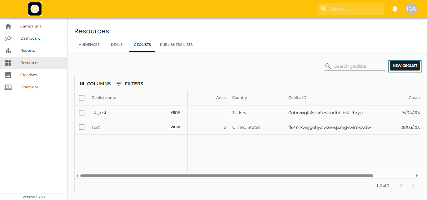
You can access this section at any time by clicking on ‘Resources’ in the Left Menu, then selecting ‘Geolists’.
To upload a new Geolist from the Geolist section, follow these steps:
1. Click ‘New Geolist’
You’ll find this button on the top right corner of the Geolist table.
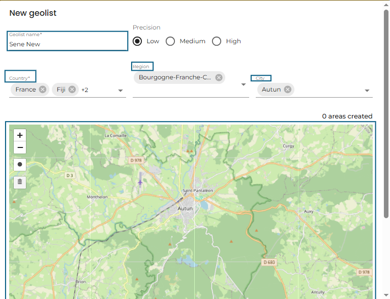
2. Complete the Geolist Setup Dialog
You’ll be prompted to enter the following information:
Name of the Geolist (for internal reference)
Precision Level: Low, Medium, or High
(Higher precision may improve targeting accuracy)Country (required): Select from the drop-down
Region (optional): Refine by specific region
City (optional): Select a city within the country/region
Target Radius (optional): Choose up to 10 km
(For conversion measurement, the radius defaults to 100m)
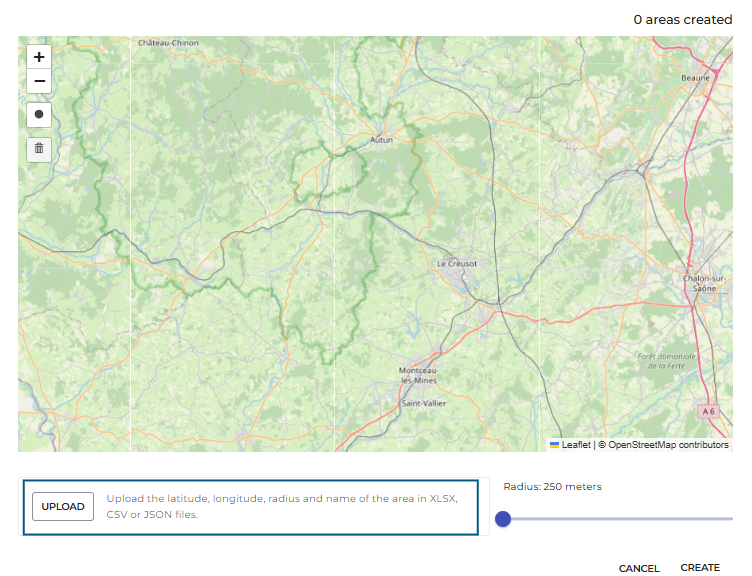
3. Add Target Areas
You have two options:
-
Upload a lat/long file with defined areas
(See advanced file format instructions) -
Draw areas manually using the built-in map tools
Use the circle tool to draw, and the eraser tool to remove.
⚠️ Note: Do not overlap areas. The maximum number of allowed areas is 50,000.
4. Save the Geolist
Once everything is set up, click ‘Create’ to save and generate the Geolist.
File Format for Geolist Upload
You can upload Geolists using either:
-
.jsonfiles (recommended) -
.csvfiles
File Requirements
Each row must represent one area, and should include the following:
Mandatory Fields
-
latitude: Latitude of the center point -
longitude: Longitude of the center point -
radius: Radius in meters (must be numerical)
Optional Fields
-
name: A label to identify the area in campaign reports -
id: An internal reference for reporting purposes
You may also encounter the field
textin downloaded reports—it behaves likename, but we strongly recommend usingnameinstead.
Important Guidelines
-
No overlapping areas: Ensure areas don’t intersect.
-
Leave space between areas: There must be a separation of several times the radius between areas.
-
The geo-targeting algorithm can handle minor inconsistencies, but significant overlap or dense clustering may break the upload.


